

Human beings have made their home in Black Rock-High Rock country for more than 10,000 years, long before Euro-American emigrants passed through on their way to California in the 19th century. Honor their history and spirit as you tread lightly on this land, ensuring another 10,000 years to come.
Ancient People, Ancient Place
The original peoples of the Great Basin lived by foraging and experienced long periods of relative stability. Archeological study speaks to the flexibility and resilience of their lifeways and a mystical connection with all of the plants, animals and the cosmos.
These original peoples made use of many plant and animal foods, concentrating on their preferred delicacies in good times, and resorting to less preferred creatures and seeds in tougher times.
Research shows smaller family bands were continually on the move with seasonal weather patterns and the availability of food. Due to the mobility of the peoples, there was little incentive to build permanent houses, so information about this era is limited.
What is clear is that a stable lifeway developed over 8,500 years ago in the Great Basin and persisted until Euro-Americans arrived in the late 1770’s.
Large Game Hunting
About 8,000 years ago, notched points were carved and strapped with sinew to notched shafts, providing a stronger implement for killing large animals, a development that would have further stabilized life for the original peoples.
Juniper and sagebrush fences were often made into corrals 450 to 1,500 feet in diameter to hold wild animals driven into these spaces. Snares, traps and fibre nets were crafted to capture small animals, further diversifying the food supply.
Cave and Rock Dwellings
In spite of these signs of early stability, reputable geologists and archeologists believe that climatic drying roughly 7,000 to 4,000 years ago tested the resilience of the Great Basin foragers.
Conditions in that time were so severe that people changed habitat locations often within the region.
Nevertheless, about 4,500 years ago, sites of human occupation and diverse lifeways emerged quickly along rivers, lakes and marshes and other habitats as the climate shifted to conditions more similar to present times.
Caves in the Great Basin have been found with well-preserved feathers, wood, fiber, hide and baskets showing a rich spectrum of technologies and economic practices. Human population began to grow and trade networks between what is now known as California began.
The Desert Archaic Culture
As ancient Lake Lahontan dried up, native peoples entered the region and walked the shoreline. They hunted and fished, leaving broken spears and discarded tools recording their presence.
As the water dropped below the mouths of the caves, the peoples took refuge in them, built campfires and stored food in dark corners. Camels, bison, shrub-oxen and horses were the primary hunted game. Watertight baskets were woven for bowls and boats, and the bow and arrow replaced the atlatl, or spear-thrower, for hunting.
Winters were cold and dry. Snow remained only for a few days allowing for animals to roam and the people to hunt for food almost daily. Along the banks the sagebrush grew twice as high and the cottontails were fat. The willows and cottonwoods provided protection from the sun.
The jackrabbit, coyote, antelope and wolf were the mainstays of food, as were ground squirrels, crickets, cottontails and caterpillars.
Piñon trees formed a thin mantle over the mountaintops at higher elevations, home to the sage grouse, marmot, and little chief hare, also known as the pika. This was the deer hunting and nut gathering land of the Indigenous peoples – if the nut crop failed, the deer became the primary source of food, as did insects and roots.
In the wisdom of the people, everything had a use and every resource was used advantageously. Water was carried everywhere and extreme climates left them living by tough standards.
The contemporary story of the Indigenous Peoples living in this region when prospectors and pioneers crossed their lands in the 19th century is of a non-pottery culture that hunted with bows and arrows.
Tools were made from the bone, sinew, and hides of animals, from the fibers and stems of plants, and from the stones of the dried-up Lake Lahontan floor called the Black Rock Desert.
In 1848, before the huge surge of migration to California in search of gold, little was known of this vast area of the West. A handful of white men had attempted to cross the mirage-filled expanse of desert that lies between the Sierra Nevada mountains and the Wasatch mountains of Utah.
Yet there were five native nations who intimately understood the region, its landscapes and wildlife.
Five Nations
This high desert region hosted five native nations. Four of them shared one basic linguistic form, while the fifth spoke an entirely different language.
To the southeast lived the Southern Paiutes, to the east were the Goshutes and the Shoshones, and in the northwest were the Northern Paiute. A smaller, unrelated nation were the Washos centered near Lake Tahoe.
The Northern Paiutes did not live in the Sierra Nevada, but the weather trends molded their daily lives. Little did the peoples know that the mountains were filled with gold, and that within one short decade, thousands upon thousands of prospectors would pour down the trails, raping their land of food and resources.
The quest for food was so pressing that many bands in the Great Basin became known for the food they most commonly used. The Paiute boundaries in Nevada became clearly marked in the 1940’s through the animals that were prolific and used as a primary source of sustenance for the individual bands.
In northwestern Nevada, north of Pyramid and Winnemucca Lakes in the Black Rock Desert and High Rock Canyon territories, the bands were known as Cui-ui eaters, Jackrabbit eaters and Rock-chuck eaters.
Story of the Trout Eaters
The Trout-eaters took their name from the high salmon-trout (agai), now known as the Lahontan cutthroat, that lived in Walker Lake and spawned in the Walker River. This unique trout was a legacy from ancient Lake Lahontan where it evolved many thousands of years ago.
The Trout-eaters made their headquarters at the mouth of the river, near their main source of food, but they also searched the desert and hills for seeds, roots, and nuts at ripening times.
Shelters
Shelters were constructed by the women and only when needed. In the mountains, they pulled sagebrush up by its roots and broke pine boughs from trees, then piled both in high circles, about shoulder height, to protect from the cold or heat. Shelters for one person were often crafted for warmth or shade. There was no doorway but a small opening to crawl into the structure.
Near the marsh edge, more substantial basket-shaped dwellings were created from cattail mats tied onto willow frames. Holes left in the tops allowed smoke to rise out. More often, shed-like structures were made without walls, offering protection from the sun. These structures lasted many seasons, and were reinforced continually.
If a death occurred in a dwelling, it was burned along with the person and their possessions to prevent their spirit from returning and pestering others in the community.
Pinenuts: A Favorite Food
Pinenuts were a favored food and harvested in great quantities in the fall. Pinecones, opened like full flowers, revealed twin nuts behind each cone-scale.
Elder Wuzzie George explains how much the pinenuts meant to the Paiute peoples:
“When we come to a pinenut place we talk to the ground and the mountain and everything. We ask to feel good and strong. We ask for a cool breeze to sleep at night.
“The pinenuts belong to the mountain so we ask the mountain for some of its pinenuts to take home and eat. The water is the mountain’s juice. It comes out of the mountain, so we ask the mountain for some of its juice to make us feel good and happy.
“Just the old people do this. The young people don’t care, they just walk on the mountain anyhow.”
Boats of Cattails and Tule
Long slender, flat cattail leaves were used in many ways after they turned brown in the fall. The Paiute braided and twisted cattails to create woven mats for bedding and blankets. Roasting and staging pits were lined with the mats and, to protect their feet, sandals were also made.
Tule grew in abundance. Pithy and buoyant when dried, it was used to make boats and decoys. Boats were floated into the marshes to gather mudhen eggs and drive flightless molting ducks to shore to make a delicious dinner.
Decoys were created from the skin and feathers from ducks stretched over woven duck forms. This method of hunting provided plenty of food in the migration seasons.
Emigrant History
“It was a singular place to travel through shut up in the earth, a sort of chasm, the little strip of grass under our feet, the rough walls of bare rock on either hand, and the narrow strip of sky above.” – John C. Fremont’s description of High Rock Canyon, 1843
Step Back in Time
The Black Rock Desert High Rock Canyon Emigrant Trails National Conservation area remains unaltered from the days when John C. Fremont first mapped the canyon in 1843-44.
During the last frigid days of 1843, John C. Fremont led his expedition through a steep walled canyon following a creek he trusted would bring him to the fabled Buenaventura River, which was thought to provide access to the Pacific Ocean.
While he did not discover a navigable waterway, he did define a system of internal drainages now known as the Great Basin. He also laid the groundwork for what was to become the historic Applegate Trail.
In 1846, Jesse Applegate and his group traced a portion of Fremont’s route, establishing an alternate trail to Oregon.
The discovery of gold in California in 1848 set off a rush of gold-seekers crossing through the Black Rock Region. During the peak year of 1849 as many as 10,000 wagons passed through the Black Rock Desert region.
More about the NCA’s 180 miles of historic emigrant trails »
A Protected Piece of Human History
Before the influx of gold seekers, the canyons were home to humans for at least 10,000 years and every rock shelter and spring has indications of this use.
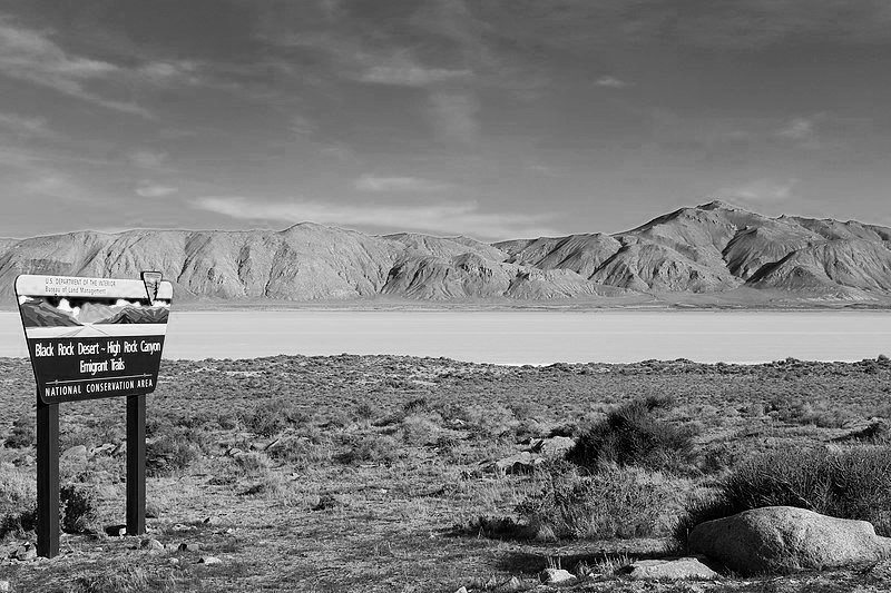
In acknowledgement of the role this incomparable landscape has played in U.S. and human history, Congress passed the Black Rock Desert-High Rock Canyon Emigrant Trails National Conservation Area (NCA) Act of 2000.
This Act gave special designation to 1.2 million acres of public lands managed by the Bureau of Land Management in northwestern Nevada known as the Black Rock-High Rock country.
Throughout the NCA and its ten Wilderness Areas, you can reconnect with the natural world much as the people who came before us did.
Land Speed Record
Land Speed Record: 763 MPH!
Did you know the current Land Speed Record was achieved in the Black Rock Desert? The land speed record is the highest speed achieved by a person using a vehicle on land, and the current LSR is held by ThrustSSC, with its driver, Andy Green. The project succeeded in establishing the LSR in 1997, and Gerlach celebrated its 20th Anniversary with Gerlach Race Days in 2017.
In addition to setting the LSR, Thrust SSC also is the first car to generate a sonic boom (which happened on Oct 7th, 1997). An official attempt on the record a few days later failed due to the car not being turned around within the statutory one hour allowed. However, on 15th October, Andy Green made the two runs through the measured mile, each time generating a perfect shockwave in front of the car and a huge sonic boom. The Land Speed Record is now faster than sound.
How to set a Land Speed Record
The land speed record is a mean of the recorded speed over a fixed distance, averaged over two passes. Two runs have to run in opposite directions and be taken within an hours time of one another!